Photo: Andy Farnsworth
Inscription
A TRIBUTE TO JOHN J. MURPHY, C.M., LL.D., 1922 - 2010, Very Devoted Citizen of St. John's.
For all he has meant and done for his beloved City -- in his terms as Mayor, and his outstanding record in other public service.
Major supporter of Harbourside Park. A Free Man of the City of St. John's. Paul Harris Fellow, Rotary International.
A self-made-man, John Murphy is remembered as kindly, considerate, eloquent, and a "true gentleman".
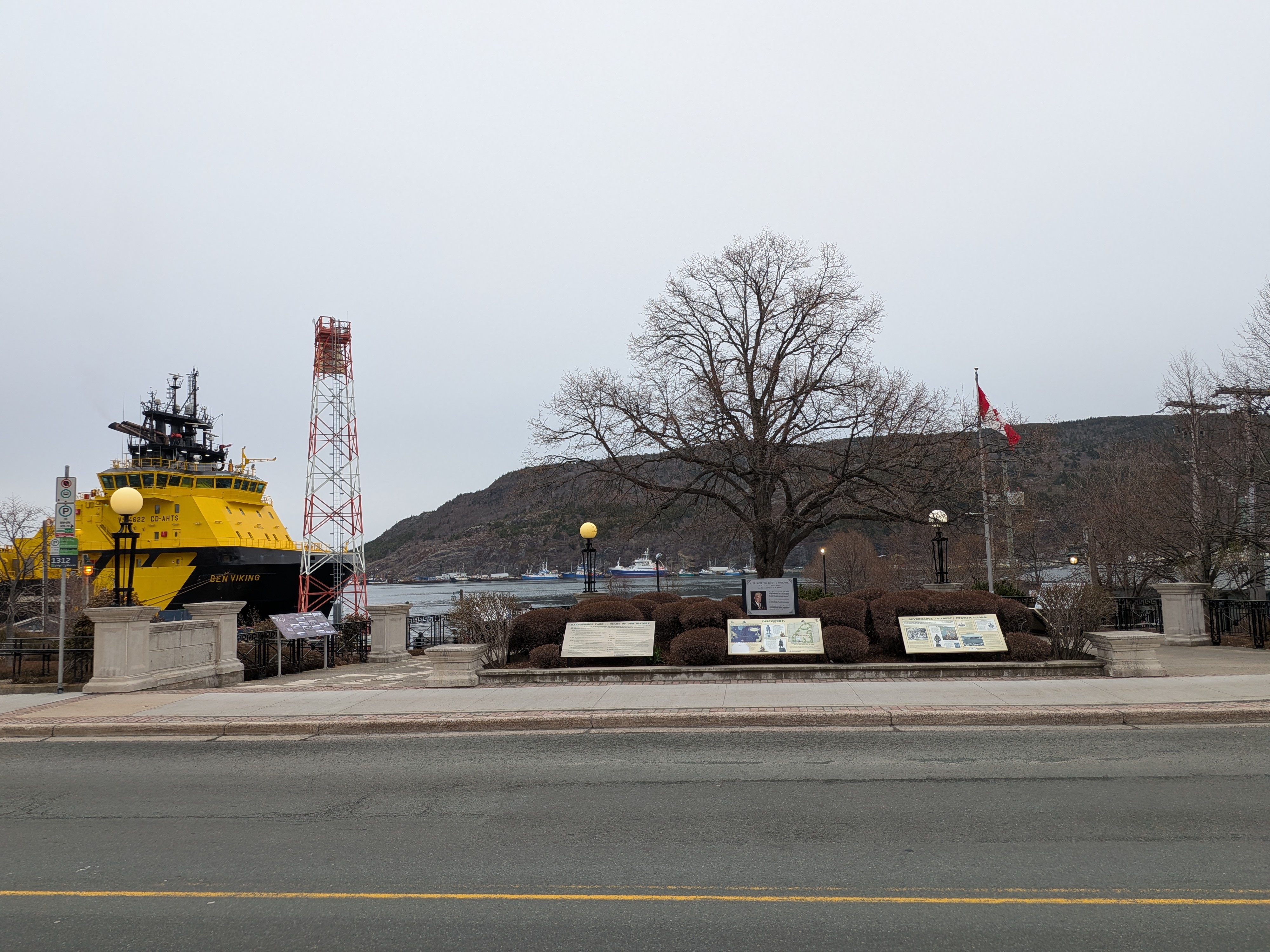
1. HARBOURSIDE PARK -- HEART OF OUR HISTORY.
For over 500 years, Harbourside Park site and vicinity, was the location for an astonishing number of Newfoundland's very important historic events. You stand on what is probably the most history-rich place in Newfoundland.
1497 John Cabot discovered Newfoundland, and named St. John's - - the oldest Port in Canada.
1500 The beginning of the Annual Migratory Fishery, centred in St. John's. Fishing was pursued by ships of England, Portugal, France, and Spain, mostly without any hostility, even though their countries were sometimes at war with one another.
1502 St. John's was visited by Jasper and Miguel Corte Real from Portugal.
1575 The first English fishing captain to enter St. John's Harbour was "Admiral of the harbour by auncient custom", and set up his shore-base here on "Admiral's Beach".
1583 Sir Humphrey Gilbert, on Admiral's Beach, claimed New-Founde-Land for Elizabeth I - - thereby starting the British Empire.
1620 The first "Planters" (year-round fishermen) and families, claimed fishing "Rooms" on the shoreline, on either side of Admiral's Beach.
1671 Fishing Admirals were made responsible for law and order, dispute resolution, and forming the constabulary.
1675 Naval Commodores replaced the Fishing Admirals. The Royal Navy was very active in St. John's, as it helped build Britain's worldwide empire.
1676 John Downing, a Planter (adjacent east), successfully petitioned the Crown to rescind an order-in-council that forbade over-winter settlement in Newfoundland.
1690s Lower Path (Water Street) and its merchants (east and west of here), became Newfoundland's oldest street and commercial district.
1729 Newfoundland's first governor was appointed representing the British Crown, responsible for the provision of law and order on the Island
1729-1939 King's Wharf was the ceremonial centre for officially welcoming Royal Visitors and famous persons such as Admiral Lord Nelson and Captain James Cook.
1750 Start of immigration from England and Ireland, landing here at King's Wharf, and at the Galway Wharf (adjacent east).
1811 The first year that England granted outright ownership of land in Newfoundland (including private ownership of part of this site).
1820-1860 For 40 years, King's Wharf was the centre in St. John's for election rallies, heated political speeches, public demonstrations, and even riots.
1824 England granted Colonial status to Newfoundland, with establishment of related rights and administration, focusing on St. John's Harbour and settlers elsewhere.
1825 Patrick Morris, a merchant with adjacent land west of King's Wharf, and William Carson, struggled to achieve representative government for Newfoundland.
1832 Newfoundland was granted the right to elect Representative Government. Located here were the first polling station, and the first Parliament - - at "King's Place" (a public house).
1833-1863 Pilot boat services were provided, for safe Harbour entry. The Customs House was built, with a navigation "Leading Light" on top.
1858/1862 Shipping interests of the Galway Line were established east of King's Wharf, and Harvey & Company to the west.
1924 Newfoundland's National War Memorial was built here - - one of the world's most magnificent war monuments - - occupying what had been Haymarket Square.
Johnson Family Foundation Grand Concourse Authority
2. DISCOVERY.
European Discovery and Exploration of North America.
Courtesy Johnson Family Foundation. Illustration Hilary Cass
Just off St. [...]asternmost point in continental North America. In the [...] and India, Explorers from England, France, Por[...] the Atlantic Ocean - - all heading toward the [...]New-Founde-Land".
[...] farther north and south, that a [...] In the meantime, the [...] fishery - - fish so plentiful [...]asket", and sometimes [...] a good fish story).
John Cabot. Although the Norse had reached Newfoundland five centuries earlier, an Italian navigator, sailing in the employ of King Henry VII of England, is considered to have "discovered" Newfoundland in 1497. According to tradition, John Cabot (Giovanni Caboto) is said to have named St. John's on the Feast-day of Saint John the Baptist, on June 24, 1497.
Gaspar Corte Real. Two Portuguese brothers from the Azores, Gaspar and Miguel Corte Real, visited St. John's in 1500-02. Because the Portuguese fishing fleets were the first to regularly visit Newfoundland, the earliest maps, show a Portuguese form of the name St. John's - - San Johan or St. Joanes. Cape Spear (from the Portuguese C. de Espera or "cape of waiting"), was a rendezvous point for the Portuguese fishing fleet.
Map of Terra Nova from the 1600s. The earliest maps of the "New Land" show headlands and place names of Portuguese, French, and English origin, bestowed by our "amateur explorers" - - the fishermen. They flocked to Eastern Newfoundland each spring, to be first to claim prime fishing locations (berths). This map shows this Harbour and "C. Spera", but exaggerates the size of "St. Joanes".
Johnson Family Foundation Grand Concourse Authority
3. GOVERNANCE / GILBERT / FORTIFICATIONS.
From the beginning of its use, the site now occupied by Harbourside Park was at the centre of most historic events in St. John's Harbour, and in early Governance of Newfoundland.
Rule by Fishing Admirals.
Courtesy Government of Newfoundland & Labrador
There is no record of when the "auncient customme" of rule by the Fishing Admirals began, but it was already well established by Sir Humphrey Gilbert's visit in 1583. The first fishing ship to enter a harbour in the Spring had the choice of a fishing room, and its captain was recognized as "Admiral" or "Lord" of the harbour for the season.
The Admiral settled disputes over the fishery and fishing rooms, attempted defence of the harbour if attacked, and administered justice. The authority of the Admirals was laid down in 1634 under the "Western Charters", and later under King William's Act of 1699 -- which has been called "Newfoundland's first constitution". The system remained through most of the 1700s.
Sir Humphrey Gilbert.
When Sir Humphrey Gilbert laid claim to Newfoundland at Admiral's Beach, on August 5, 1583, there likely were wharves off the beach for convenient landing of small boats, but still no settlement. However, at that time, there were 36 fishing boats from at least three nations in the Harbour.
Sir Humphrey Gilbert's Proclamation on August 5, 1583, painted by Harold Goodridge, and given to the City of St. John's by Maurice H. Saval.
Courtesy City of St. John's
Maurice H. Saval, D.Litt., LL.D., a businessman from Boston, visited St. John's for more than 50 years, beginning in the 1930s. He became a substantial benefactor of Memorial University and bequeathed a significant gift, for enhancement of Harbourside Park.
Naval Commodores.
During the early 1600s, the Royal Navy provided escort to the British-Newfoundland fishing fleet. From 1675, the officer in charge of the convoy was made Commodore of the Newfoundland Station, headquartered in St. John's.
The Commodore was instructed to help the Fishing Admiral maintain law and order, and gather information on the fishery. Under King William's Act of 1699, fishermen could appeal decisions of the Fishing Admiral to the Naval Commodore.
Governors.
Beginning in 1729, the Commodore of the Newfoundland Station each season was also commissioned Governor of Newfoundland. From 1729-1817 these Naval Governors were present only during the fishing season, and were headquartered in St. John's. The first Governor to be instructed to over-winter was Sir Francis Pickmore in 1817.
Governors appointed from England always came ashore at the King's / Queen's Wharf, Governors, and since 1949, Lieutenant Governors, have performed the Vice Regal responsibility for nearly 200 years.
Sir John Thomas Duckworth, after whom Duckworth Street is named, was Governor of Newfoundland, from 1810 to 1812.
Fortifications.
Courtesy Lane Photographics
1 Signal Hill was garrisoned by the British from the 1790s to 1870. During World War II, American coastal and anti-aircraft batteries were located at the top of Signal Hill. 2 Queen's Battery was manned from 1796 until 1870. 3 Fort Waldegrave was constructed in 1798, on the site of a century-old fort known as the North Castle. It was maintained until the 1860s, and reactivated during World War I. 4 The site of fortifications since 1698, Chain Rock Battery commands the Narrows. Remnants of World War II structures can still be seen there. 5 Fort Amherst was fortified in 1777. Newfoundland's first lighthouse was added to the fort in 1813. Abandoned by the British in 1870, it was fortified for both World Wars. 6 South Castle, located near the Prosser's Rock Boat Basin, was the base for the first defence of the Narrows in 1673. Permanent fortifications were built there in the 1690s. Frederick's Battery was built nearby in the 1740s and remained in use until 1852.
Johnson Family Foundation Grand Concourse Authority
4. SETTLEMENT AND GROWTH.
Our native peoples were in Newfoundland as long ago as 4000 BC. In 1000 AD, the Norse, who settled for a short time at L'Anse aux Meadows, in northern Newfoundland, were our earliest European Settlers. This Historyboard refers mainly to the Settlement and Growth of St. John's, by European Settlers of the 1600s to the 1800s.
Early Fishing Settlement Activities.
The Newfoundland fishery of the early 1500s was seasonal, from April to September, carried out by crews from England, Portugal, and France. The favoured harbours were those closest to Europe, with supplies of fresh water, and beaches for the drying of fish. A supply of wood was needed for wharves, fish-flakes, cooking, and rough shelter (often roofed with sails). The earliest indications of houses and over-wintering at St. John's are from the early 1600s.
John Guy and Lord Baltimore.
The earliest year-round settlements in Newfoundland were in Cupids in 1610, by John Guy, and in Ferryland in 1621, by George Calvert (Lord Baltimore). Both those settlements were abandoned, but individual settlers remained.
By the 1620s, the first of the "planters" began to settle in St. John's. A planter was a land-based fisherman who had a boat, a crew, and fish flakes on shore. Some of the crew manned the boat and fished, and others stayed onshore to dry and salt the fish. Some planters stayed over the winter to protect their belongings. Eventually, some women joined the men and households were set up. In a 1675 census, there were 1,659 people, in 34 harbours, on the "English Shore", between Bonavista and Trepassey. St. John's was the largest settlement, with 261 people, consisting of 19 planters, their families, and fishing servants.
John Guy. Lord Baltimore.
The Legality of Settlement.
When the fishery was seasonal, it was chiefly controlled by ship-owning merchants from Poole, Dartmouth, Bristol, and Plymouth, in West Country England. As soon as planters settled, they needed provisions and to sell their fish. Local branches of West Country merchants had to compete with new local merchants.
Because of protests in England against settlement of the island, in 1675 Sir John Berry brought over an order-in-council that all planters return to England. This was opposed by the most prominent St. John's resident, John Downing, who had fishing premises just east of this site. Downing went to England and successfully pleaded the residents' case. He has been called "The Father of Permanent Settlement".
Growth of Settlement.
A 300 year ban on permanent structures, which ended in 1811, slowed the growth of early settlement in St. John's. By the early 1800s, however, the population had grown to 5,000. There were three main streets running east and west, parallel to the harbour: Water Street, Duckworth Street, and Gower Street, with connecting lanes and paths.
Thornton's Map of St. John's, 1689.
This earliest known map of St. John's Harbour shows the names of the "planters" (resident fishermen). The King's Beach is just to the left of the name "Downing".
Most planters maintained a household, which included a wife, children, and fishing servants. Some also kept a tavern or small store as a sideline.
Johnson Family Foundation Grand Concourse Authority
5. HARBOUR PILOTS / LEADING LIGHTS.
Marks for Entering the Narrows, 1885.
Spire of Congregational Church White Leading Mark Leading Mark into St. John's Harbour.
Courtesy City of St. John's Archives
Starting in the late 1600s, naval vessels assigned to Newfoundland for the fishing season patrolled St. John's Harbour. Crews from these vessels took to longboats to pilot ships having difficulty entering the Narrows, a common occurrence because of prevailing winds and lack of sea room. Beginning in the early 1700s, captains requiring the expertise of a pilot were advised that "the fishermen are trustworthy pilots, and always to be found off the harbour during daytime."
By 1833 the piloting of boats through the Narrows was a growing business. Four accredited piloting crews used whaleboats in their work. Pilot boats vying for work met ships just off Cape Spear in the sheltered area known as "Pilot's Gulch", or approaching ships could signal their need for a pilot to Signal Hill, from where the request would be relayed to the Harbour Master's office.
Old Customs House and Leading Light.
Courtesy City of St. John's Archives
In 1863, the Lighthouse Commission erected two gas-powered leading lights, the lower one atop the Customs House and the higher one in a pillar on Queen's Road. A modern leading light is on a tower directly behind you – the other, several hundred feet up the hill, on the steeple of a former Congregational Church, on Chapel Street and Queen's Road. A vessel is assured of a safe line to enter the Narrows by steering so that the two lights line up.
Chart of St. John's Harbour, 1885.
In 1875, the position of Harbour Master was created. From his office at the Queen's Wharf, the Master was responsible for assigning berths, keeping the Narrows clear, and certifying masters and mates. The first Harbour Master was a retired Royal Navy officer, Commander George Robinson, who completed this chart of the harbour in 1885. The second was Captain Ned English appointed in 1891, and remaining in the position for 30 years. In 1900, the newly created St. John's Pilotage Authority also came under his supervision.
Courtesy City of St. John's Archives
Early Pilot Services.
Following Confederation with Canada, jurisdiction over pilotage changed several times. From 1949 until 1965, pilot boats came under the auspices of the St. John's Pilotage Authority. In 1965, the National Harbours Board assumed jurisdiction until 1972. Since then, piloting services have been provided by the Atlantic Pilotage Authority, which operates under the direction of the Canadian Coast Guard.
The first steam pilot boat, 1910. Courtesy Newfoundland Quarterly Steel Pilot Boat, built at Dockyard. Courtesy Fred Chancey
Aerial View of the Narrows, 1940s.
At its narrowest, between Pancake Rock and Chain Rock, the Narrows is only 60m wide. In this photograph World War II submarine nets across the harbour entrance can be seen. At centre-right, a warship is anchored at the King's Wharf.
Courtesy City of St. John's Archives
Johnson Family Foundation Grand Concourse Authority
6. FAMOUS VISITORS.
Embarkation of Prime Minister John Kent, King's Wharf, 1859.
King's (Queen's) Wharf has been the place where public officials arrived and departed. It has also been the main anchorage-point for the Royal Navy.
Captain James Cook.
Newfoundland was the cornerstone of the Empire in the days when the "Britannia Ruled the Waves". As a consequence, many of the most famous figures of the 18th and 19th centuries have landed at the King's (Queen's) Wharf. These people include: the world explorer and cartographer Captain James Cook; Captain Horatio Nelson, (later known as Admiral Nelson, the hero of the Battle of Trafalgar); and Captain Bligh ("Mutiny on the Bounty").
Prince William Henry.
The earliest visit to Newfoundland by a member of the Royal Family occurred in 1786, when Prince William Henry (later King William IV) arrived, in command of the frigate Pegasus. The Prince assembled the populace on the King's Beach to witness the flogging of some mutinous sailors, and to recite an oath of allegiance. Royalty of other nations visited St. John's while in their country's naval service. These included Prince Henry of Holland in 1845, and Prince Napoleon of France in 1861.
The Royal Visit of 1860. Arrival of the Prince of Wales from Queen's Beach.
God Save the Queen
The first Royal State Visit to Newfoundland was that of the Prince of Wales (later King Edward VII), in the Hero, July, 1860. After his week-long visit, virtually the entire population of St. John's turned out to see the Prince's departure.
His Majesty's Steamship Ophir, by the King's Wharf, 1901.
On October 23, 1901, the Duke and Duchess of York visited St. John's.
Since the building and dedication of Newfoundland's National War Memorial at this location in 1924, Royal Visits have generally commenced with solemn, wreath laying ceremonies.
There have been a number of Royal Visits to the Newfoundland War Memorial since 1939 including:
King George VI and Queen Elizabeth, June, 1939. Princess Elizabeth and Prince Philip, November, 1951. Queen Elizabeth II and Prince Philip, July, 1978. Prince Charles and Princess Diana, June, 1983. Princess Anne, June, 1991. Queen Elizabeth II and Prince Philip, June, 1997.
Queen Elizabeth II and Prince Philip at the War Memorial in June, 1997.
Courtesy Government of Newfoundland & Labrador
Johnson Family Foundation Grand Concourse Authority
7. POWER TO THE PEOPLE.
Patrick Morris and William Carson.
Patrick Morris was born in Waterford, Ireland. After arriving in Newfoundland in the early 1800s, Morris became heavily involved in trade and in bringing immigrants from Ireland, to premises just west of the Queen's Wharf.
In the 1820s, along with Dr. William Carson, and the support of the many Irish immigrants he had brought here, Morris led the fight for representative government. This fight was won in 1832.
Morris. Carson.
Account of the 1832 Election.
THE Royal Gazette November 6, 1832
The first-time voters crowded hustings [political speakers' platforms] set up in front of the King's Place Tavern, the polls being held within. An assortment of party-coloured badges and silken banners were displayed, with mottoes such as: "Trade, Fisheries -- No Taxation"; "The Guardian of Our Rights, Wm Thomas"; "Speed the Plough"; "Kent, the O'Connell of Newfoundland"; "Kough and Independence". Every window commanding a view of King's Beach was thronged throughout the day with spectators, principally of the softer sex, who appeared to take a lively interest in the proceedings. Indeed, the whole scene presented a most novel and animated appearance.
The Bow-Wow Parliament, 1832.
As many as are of that opinion say ... Bow! Of the contrary - Wow! The Bows have it.
In 1832, Newfoundland was granted a Legislative Assembly, which drew gentle chiding from the English cartoonist, John Doyle.
This area, the scene of many incidents of popular unrest and political agitation, was the site of St. John's first election campaign in 1832. Candidates spoke from a platform set up in Haymarket Square (current site of War Memorial). Later, the session of the Assembly sat here, at the King's Place Tavern, on the corner of King's Road and Duckworth Street.
The Colourful Language of Politics.
If I should be so happy as to succeed, I shall be the determined advocate of the economy, and opposer of local patronage to strangers, to the extent of my humble abilities. John Kent, Public Ledger, September 14, 1832
In the same ranks, we have had many a political battle for freedom and our country. There is now no spot on the globe as free as Newfoundland. Dr. William Carson, September 20, 1832
In the Newfoundlander was an extremely abusive letter from a man of the name of Kent, a mischievous demagogue. We have tried to reason with him but found him to be quite incoherent. Public Ledger, October 12, 1832
View of the Queen's Wharf and Customs House Square in 1879.
This area of St. John's was the major gathering place in the 1800s. Not only were the Queen's Wharf and Customs House at this site, but immediately to the east was the "Galway Wharf", used by the transatlantic passenger ships, one of which can be seen in this drawing.
Johnson Family Foundation Grand Concourse Authority
8. NEWFOUNDLAND'S NATIONAL WAR MEMORIAL.
One of the World's Most Beautiful Monuments.
Located on Hay Market Square, facing Water Street and King's Beach.
Field Marshall, the Earl Douglas Haig, Unveils the National War Memorial, July 1, 1924.
Courtesy Centre for Newfoundland Studies Archives.
The ceremony began with a parade of seven Military and City bands, Army, Forestry Corps and Naval veterans, as well as contingents from visiting American, British, and French warships. The parade assembled at the Railway Station and proceeded along Water Street. Representatives from outports, members of Church Brigades, Boy Scouts, and Girl Guides lined the route, and fell in behind the Veterans as the parade passed. The parade and ceremony were described as the "largest and most spectacular gathering in the history of Newfoundland".
The Symbolism of Newfoundland's War Memorial.
This majestic, world-famous monument rises by elegant, curved granite [...] fifty feet above Water Street and seventy feet over King's Beach and the [...]
Crowning the Memorial's beautiful high terrace, stands a grand cenotaph, co[...] Newfoundland's wartime sacrifices. On its various levels, the cenotaph prese[...] heroic-size, bronze statues. Installed at its base, are three large bronze wreaths [...] who served and sacrificed in the First and Second World Wars, and the Korean [War].
Standing atop the cenotaph, is the figure of Victory, holding the torch of [...] and sword at-the-ready. Below Victory, are a stone cross and bronze statues of our courageous loggers and fishermen, who came forward into the armed forces, as well as our forestry corps and merchant navy. On the left wing of the cenotaph is a sailor, and on the right, a soldier, representing those who fought for the Colony and Empire.
The design of the Memorial's renowned park-like setting, the bold yet graceful iron and stone work, and the symbolic statuary, were the inspired collaboration of William Howe-Green, Basil Gotto, and Rudolf Cochius. The magnificent statues came from the artistic genius of British sculptors F.V. Blundstone (Victory, Soldier, and Sailor) and Gilbert Bayes (Logger and Fisherman).
Governor Allardyce entertains Field Marshall, the Earl Lord Douglas Haig, at Government House, July 1924.
The former Commander-in-Chief of the British Forces in France, the Earl Haig accepted the Committee's invitation to unveil the Monument on July 1, 1924. During what came to be known as Haig Week, he also attended a regatta held in his honour, and numerous other functions.
National War Memorial Committee Resolution, May 1922.
Whereas the King's Beach is the cornerstone of the Overseas Empire, and
Whereas the King's Beach is the site that overlooked the embarkation of so many of those for whom the Monument will stand and also overlooked the return of the broken and the maimed,
Whereas it is the only site of easy access in the City and may be seen by all who enter and leave our harbour
Whereas it is the only site approved by the general public:
BE IT RESOLVED that this executive of the National War Memorial Committee decide that the National War Memorial be erected on the King's Beach.
Courtesy Provincial Archives.
Johnson Family Foundation Grand Concourse Authority
Commemorates 1497–2010