Photo: Andy Farnsworth
Inscription
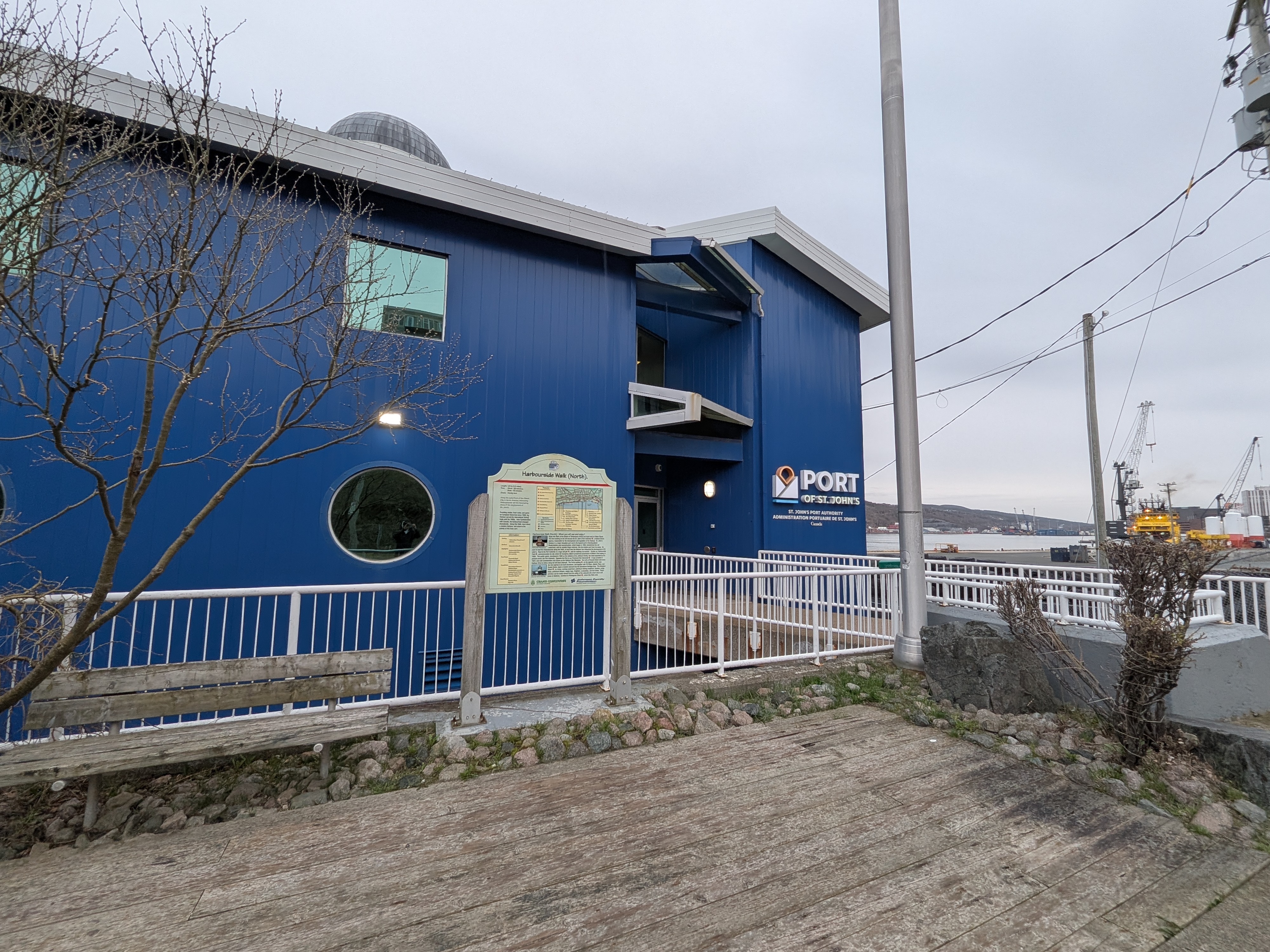
Harbourside Walk (North).
Length: 1.9 km (1.2 miles). Time: Stroll - 20 minutes, Brisk - 15 minutes. Grade: Mostly level.
Along the waterfront of the Oldest City in North America, interesting Historyboards tell the fascinating story of the development of St. John's.
Providing shelter, fresh water, and game for European fishermen since 1500, the Harbour served the international fishing trade until the 1900s. After Confederation with Canada, the harbourfront changed dramatically. Along this Walk, learn about a modern Harbour, and observe the activity of this busy port.
Features - 1. Temperance Street. 2. St. John's Port Authority. 3. Salt Pile. 4. Harbourside Park. 5. Provincial War Memorial. 6. Fortis Building. 7. Marginal Wharf. 8. Waldegrave Street. St. John's Port Authority
Symbols - Harbourside Walk North. Other Grand Concourse Walks. Direction of View. Junction. Hotel.
Information - Parking: Metered parking along all streets. Surface: Concrete sidewalk. Highlights: Harbourside Historyboards, Harbourside Park, Port activity. Bus Stops: Plymouth Road, Duckworth Street, Water Street. Food/Drink: Convenience Store on Battery Road, Restaurants and cafes on Duckworth and Water Streets, Hotels near Cavendish Square. Rest Rooms: Atlantic Place, City Hall.
Historyboard Titles. 1. Directory. 2. Growth of St. John's. 3. Ship's Rooms. 4. Four Attacks, Four Great Fires. 5a. The View from Here. 5b. The King's Beach and Queen's Wharf. 6. The Old Waterfront. 7. Merchants and Ships. 8. Churches and Public Buildings. 9. Fisheries and Sealing. 10. The Great Wars. 11. Trading Near and Far. 12. Made in Newfoundland. 13. The Port and Container Terminal. 14. Directory.
Harbourside Walk (North) - What you will see and enjoy ! Begin this Walk at the bottom of Temperance Street and head west on Water Street. The first building on the left houses the St. John's Port Authority, a federal Crown agency, responsible for the development and regulation of the Harbour. St. John's Harbour is a major Canadian port and is the busiest port in Newfoundland. Modernization and reconstruction, which began in 1959, transformed the old waterfront, with its wooden finger-wharves, into the modern port that it is today. Be sure to read the Historyboards along this Walk, to learn how the Harbour has influenced the development of St. John's. Next to the Port Authority is a huge salt pile, sold for roadway ice-control. Further on, Harbourside Park commemorates the site where Sir Humphrey Gilbert proclaimed possession of Britain's first colony in 1583. This public space, developed in 1983 on the initiative of the Johnson Family, has been expanded by it's present owner, the Port Authority. Opposite the Park is our Provincial War Memorial. It was unveiled in 1924, and until Confederation was known as the National War Memorial. Turn left at Prescott Street and cross Harbour Drive to follow along the left hand sidewalk. The Fortis building, on the opposite corner, was the first highrise to be built downtown, and together with TD Place, Atlantic Place, and Scotia Centre, inject a modern element into the Downtown Heritage Area. The Marginal Wharf is a busy, working waterfront, catering to fishing longliners, trawlers, cargo ships, petroleum tankers, supply tugs, freighters, cruiseships, and tour boats. These activities can be easily viewed from the safety of the sidewalk (the wharf area is off limits to Walkers). Continue to Waldegrave Street, where this Walk ends.
Harbourside Historyboard. Ship near Harbourside Park.
GRAND CONCOURSE The Walker's Paradise. Johnson Family Foundation Research, Design, and Installation.
Commemorates 1500