Photo: Andy Farnsworth
Inscription
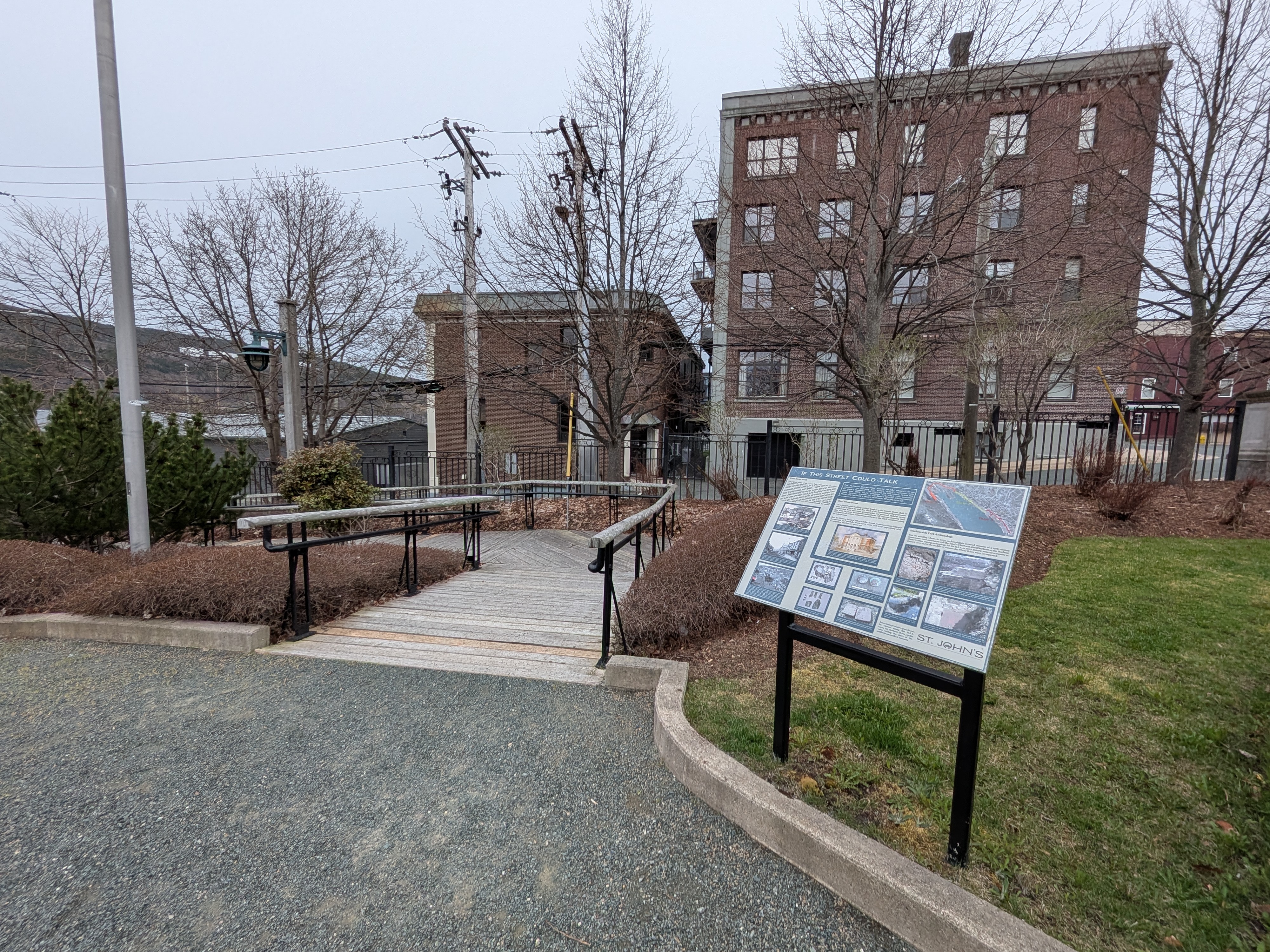
IF THIS STREET COULD TALK
Water Street Adrift
The original course of the "Lower Path" followed the shoreline, but demand for shore space led to building out over the water, followed by filling to "make ground". After each of the great fires rubble was pushed into the harbour. After the 1892 fire Water Street was re-routed west of the King's Beach, widened and straightened by shifting its route to the north (i.e. away from the harbour), and removing a turn in the street which had traced the point of the King's Beach. Generally, the natural shoreline of St. John's harbour runs beneath the south (harbour) side of Water Street, but here it was moved "inland," and is now 7 m (23 ft) above sea level. An alleyway between the King George V building and Harvey's offices at Queen's Cove approximates the earlier course of Water Street.
THE HARBOUR INTERCEPTOR SEWER (H.I.S.) PROJECT IS AN UPGRADE TO IMPROVE THE WATER QUALITY FLOWING INTO ST. JOHN'S HARBOUR. THE RED LINE ON THE AERIAL PLOTS THE 2007 AND 2008 ROUTE THROUGH THIS AREA. THE HISTORIC TOWN CENTRE, KNOWN AS THE KING'S WHARF (HARBOURSIDE PARK) AND THE KING'S BEACH (NATIONAL WAR MEMORIAL).
The Custom House
The principal public building at Kings Beach was the Custom House. Built in 1847, it fell victim in the 1892 fire. Much of the foundation of this impressive structure has been uncovered, photographed and surveyed. Reliable survey data from the many foundations encountered will improve mapping (and anticipation of) historic subterranean features as the H.I.S. continues along its easterly route.
Both the Harbour Masters' office and the Custom House have been diligently documented and carefully re-buried in 2003 and 2007 respectively after investigation, and thus are preserved.
Harbourside Park Archaeology
You are standing where, in 2003, archaeologists exposed remains of a 19th century stone house, once associated with the King's Wharf and identified later as the Harbour Master's office. During archaeology for the H.I.S. in 2007 historic structures nearby at Queen's Cove and in the middle of present day Water Street were investigated.
The Custom House was located partially in Water Street and on the National War Memorial grounds (see inset map). This 1902 painting, by John W. Nichols, hangs in the Humphrey Gilbert Building. Note the brick surrounding wall at left and portico columns.
Many artifacts from the shops on the left have been discovered in the middle of Water Street during later digs. Brian Job's Cove at right, this circa 1893 view towards King's Beach, shows how Water Street curved inland before the 1892 fire.
The Athenaeum (built in 1875 on Duckworth opposite Cathedral Street) suffered a grand view before it was destroyed in the Great Fire of 1892. At top left, a small section of then Prescott "Firebreak", now Henry Street, is visible. The white-trimmed buildings at lower right just John, then Job's Cove (at left), and the same buildings along the curve in Water Street as shown in close-up above. Burned lands and buildings on the lower slopes of Signal Hill are in the distance.
Five-fused crystallites from a crockery shop at 100 Water Street.
Copper chimney carbide canisters, used to produce acetylene for the harbour leading light, were found during the Custom House excavation, 2007.
A blanket of fire rubble and brick lies under Water Street in front of the King George V Building.
The west wall of the Custom House and the surrounding fence (brick perimeter wall) were discovered in amazingly good condition. The archaeologists' metre-long stick help us see the size, during the survey and documenting.
Melted bottles from a tavern at 114 Water Street, at the corner of St. John's Lane.
The dig, for archaeology discovery and H.I.S. installation, gained 'much local interest.
The red brick of the Custom House porch basement floor and its western wall were unearthed at 2.8m (9.1 ft). The red arrow points to where a portico column once stood.
Stone steps from the Custom House were unearthed during the 2007 archaeological investigations for the H.I.S. construction.
More interpretive panels can be viewed along the H.I.S. route on Harbour Drive, to the west, telling the story of the artifacts unearthed beneath.
ST. JOHN'S
Commemorates 1847–2008